First documented ascent
On 28 October, Terris Moore and Richard Burdsall reached the summit. Moore also recorded the six porters, one of them a woman, who accompanied the party from the monastery to base camp.[10]
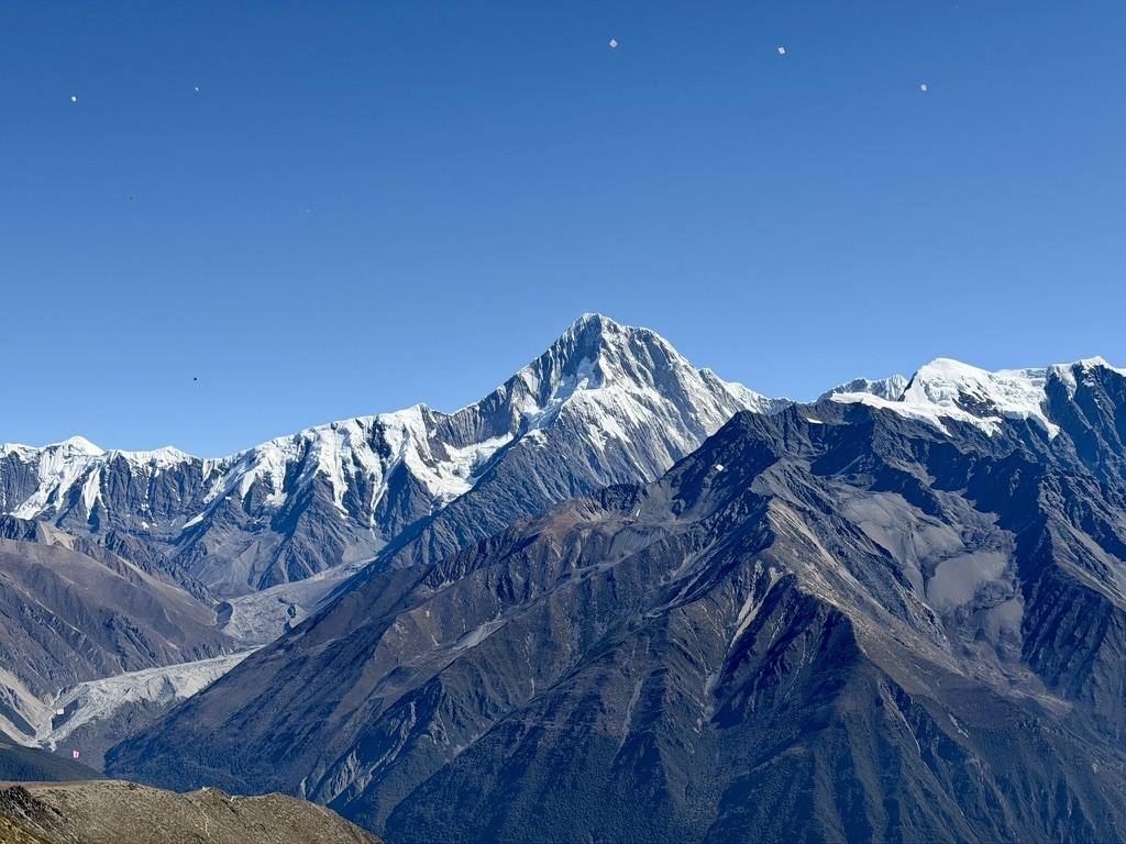
At 7,508.9 metres, Sichuan’s highest peak is a sacred mountain in the Muya Tibetan tradition.
Start in Chengdu, in southwest China, and look west towards the Tibetan Plateau. Along its southeastern edge rises the Daxue Shan, part of the Hengduan Mountains. Gongga is its highest summit.[02]
East of the summit, the Dadu River flows at roughly 1,000 metres. Across about 30 kilometres, the land rises above 7,000 metres. Where the contour lines crowd together on the map, the ground is especially steep.[03]
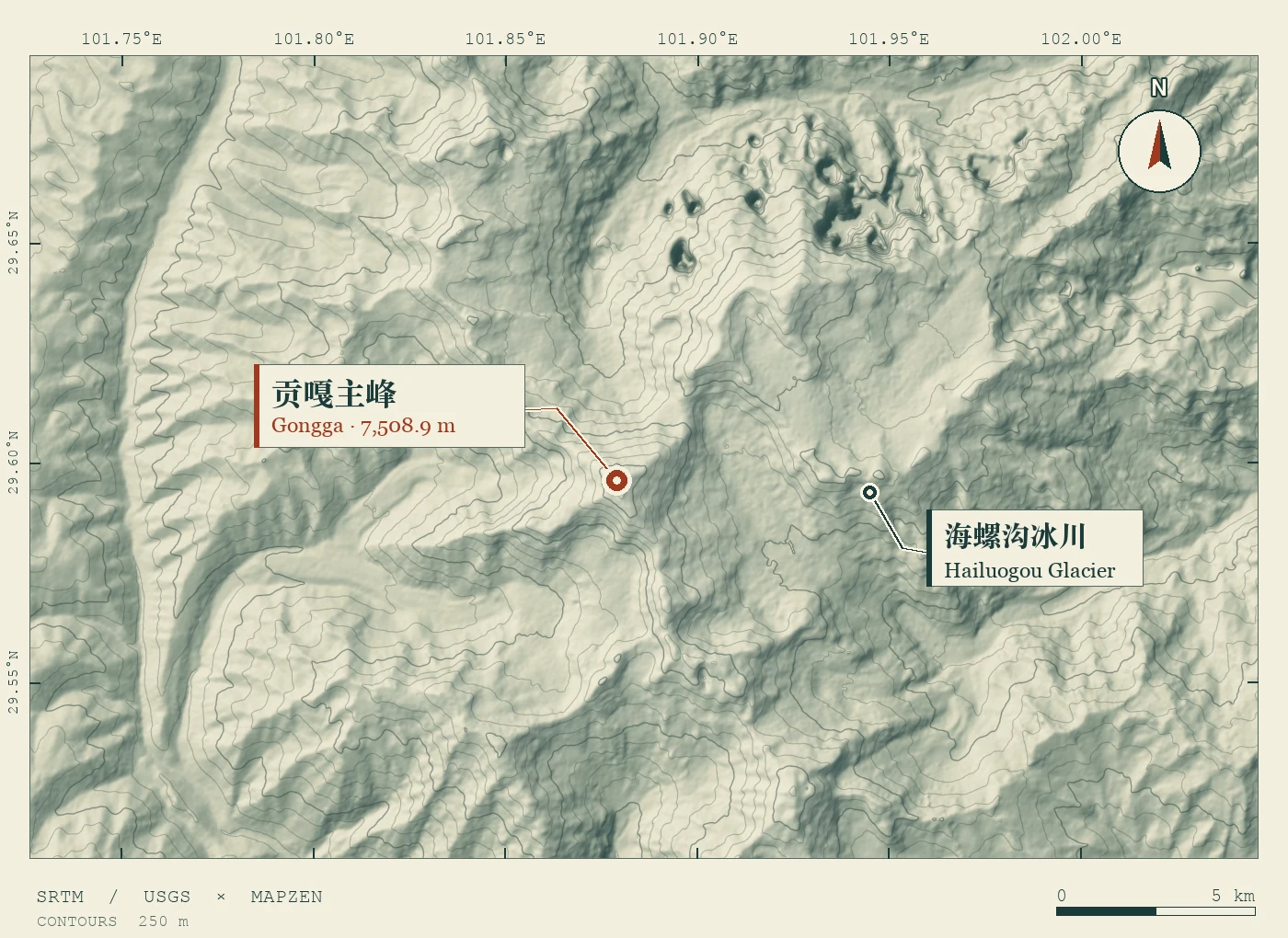
On Gongga’s eastern side, monsoon moisture feeds snow and ice. A tongue of Hailuogou Glacier once reached down into the forest. In this one valley, researchers can watch ice retreat and plant life return.[05]
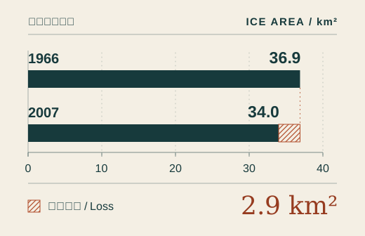
Researchers traced glacier edges on a 1966 aerial survey and on satellite imagery from 2007. Seven glaciers lost about 2.9 km² between them, or 7.8% of their area. Hailuogou Glacier itself accounted for 0.92 km² of that loss.[04]
Freshly exposed ground is mostly rock and gravel. Herbs take root first. Willow and poplar follow; fir grows on older ground. By comparing sites exposed at different times, scientists can study a century of forest development along one valley floor.[06]
Near Zimei village, a camera trap photographed a black musk deer. It was the first confirmed record of the species in Sichuan; the photograph tells us when it was documented, not when it first arrived.[12]
Hailuogou means “Conch Valley”. What is a seashell doing in the name of a valley so far from the sea?
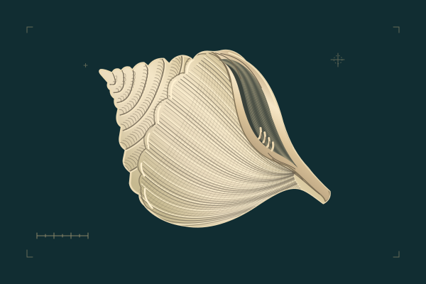
One version recorded by the local scenic area follows the Tibetan master Thangtong Gyalpo. Crossing Gongga on his way to build a monastery and stupas on the west slope, he stopped to meditate under a rock shelter. The mountain deity took out a treasured conch and used it to name the valley he had crossed.[07]
The same source preserves two other explanations. In one, a large rock resembles a shell; in another, No. 1 Glacier looks like a white conch. All three versions belong to the valley’s local lore.[07]
In a story told at Kangding’s Muya cultural site, the king sees Gongga arrive at his feast with the mountain spirits. They promise to guard the land. At daybreak he climbs to a lookout: the peaks stand all around him like a wall.[08]
An expedition diary, a permanent field station and a modern survey each tell us something different about the same mountain.
On 28 October, Terris Moore and Richard Burdsall reached the summit. Moore also recorded the six porters, one of them a woman, who accompanied the party from the monastery to base camp.[10]
On 13 June, six members of a Chinese mountaineering team stood on Gongga’s summit, a milestone in the country’s high-altitude climbing history.[11]
The Chengdu Institute of Mountain Hazards and Environment established a station in Hailuogou. Researchers could return year after year to measure the same glaciers, streams, weather and forests.[05]
China published the summit elevation of 7,508.9 m. Older sources often give 7,556 m. The difference between those published figures is not a measurement of the mountain physically shrinking.[01]
Locate Moxi town and Hailuogou together on a map to understand the eastern approach. Check the scenic area’s notices before you travel for transport and the viewing areas currently open.
Official visitor information ↗Conservation worker Zou Tao recalled that residents of Gongba valley, home to Gongga Monastery, refrained from hunting, logging or even digging caterpillar fungus there. Ask before photographing people or entering monastery spaces.[09]
View the glacier from open viewpoints. Keep off the ice tongue and out of ice caves. The relief plate helps you read the landscape; follow local signs and stay on open routes when visiting.